Exploring how volcanoes move, crack, and breathe.
My research integrates field observations, geophysical monitoring, and computational modeling to better understand the processes driving volcanic and tectonic activity.
Current Project:
NSF-Funded Study - Kilauea Volcano, Hawaii
This project investigates seismic anisotropy at Kilauea Volcano to map how subsurface stress and magma transport evolve before, during, and after major eruptive events. Findings will help improve our understanding of volcanic processes and hazard forecasting.
Past Research Highlights
-
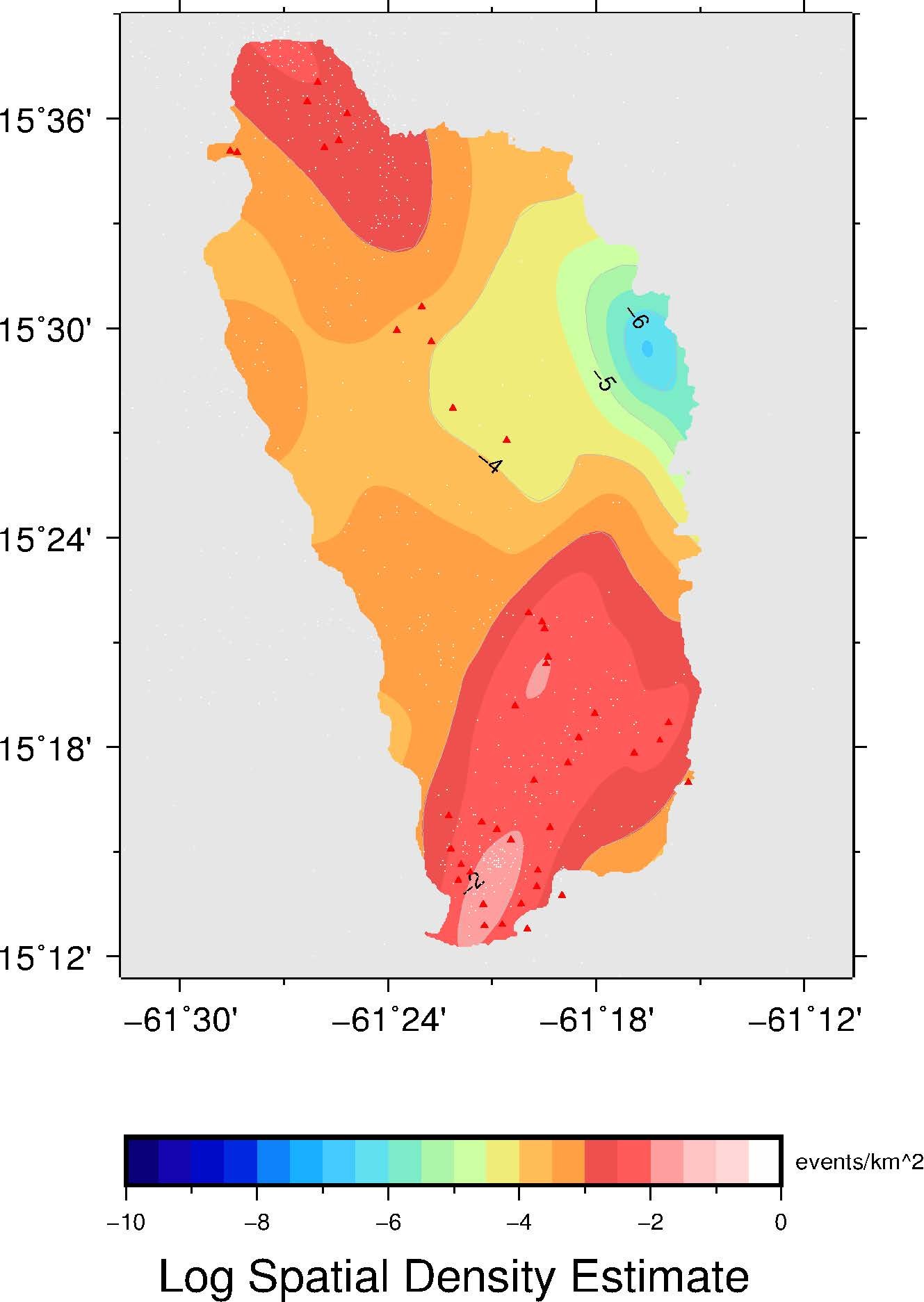
Dominica Volcano-Tectonic Hazard Assessment
Combined geological and geophysical data to model long-term volcanic hazards
-
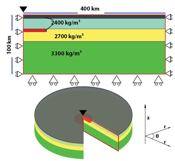
Tohoku Volcanic Arc Modeling
Used finite element modeling to study magma underplating and its influence on topography
-
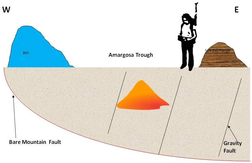
Amargosa Valley Buried Volcano
Led magnetic data collection and processing for a high-resolution survey to map subsurface volcanic structures.
Methods and Skills
Seismology (active and passive source)
Geodesy (GNSS)
Numerical/statistical modeling
Potential fields (gravity, magnetics)
Geophysical data integration
Publications
For peer-reviewed papers, conference presentations, and collaborative works, see my Publications page.
Extended Field Notes
I post informal trip logs, photos, and behind-the scenes setup details on Geology in Heels.